


To the brink...
Exploring South Africa's Great Escarpment.

As the third quarter of South Africa’s school year was beginning to wind down and my body and mind were starting to manifest serious signs of fatigue, it sure felt like a break was in order. So when some fellow volunteers invited me to join them on a little get-away to the cusp of South Africa’s Great Escarpment, I couldn’t pass up the opportunity. A couple of weeks later, with schools closed, four of us stuffed our gear and our bodies into a small hatchback for the four-and-a-half hour drive across southern Africa’s defining central plateau to the Great or Drakensberg Escarpment — a region dramatically different, in so many ways, from where we had been living and serving for the past year.


The sinuous but serviceable roads across the plateau traversed a tapestry of landscapes, villages, climates, vegetative zones, orchards, farms and even industrial sites. Indeed, about half way there I was taken a bit off-guard at the stark sight of the Belfast Colliery. For me it was the first of several flashbacks during that five-day sojourn — this one transporting me to the Allegheny Mountains where I once lived and still visit regularly — and a reminder of the central role that vast reserves of coal play in driving the power plants and economy of South Africa. Also noteworthy was the change in temperatures as we crossed the eastern (and higher) expanse of the plateau; although the windows went up and down several times, the trend was toward cooler conditions as we neared our destination on the eastern escarpment. The bracing, fresh air that greeted us that evening in the comely mountain town of Graskop felt good, and the sense of novelty and opportunity were equally welcome: after almost a year of living in the flat, dry bush-veld, the promise in these verdant mountainous landscapes loomed large, at least in my mind.
The Drakensberg (“Dragon Mountain” in Afrikaans) Escarpment forms a 1000 km rim of steep cliffs, jagged peaks and deep gorges that tracks the eastern and southern flanks of the country. As I understand it, this formation owes its existence to tectonic processes that were underway during the break-up of the super-continent Gondwana some 150—180 million years ago (MYA). At that time, diverging lateral pressures within the earth’s crust caused it to stretch and eventually break apart and sink to form long, wide rift-valleys. This legacy is evident in the north-south running valleys that bisect several of the countries to our north — a system that has yielded many of the seminal discoveries into the nature and origins of humankind over the past century. In South Africa, however, the ocean has swallowed up one side of the valley, leaving only the wall on its western flank. This wall, which has been creeping steadily westward due to the forces of weathering and erosion over the last 150 MYA, forms the basis for the region’s dominant feature topographic feature: the Drakensberg Escarpment. Thanks to these unrelenting geological forces — coupled with the nearly continuous uplifting of the earth’s crust in this region — these dramatic landscapes are chiseled and precipitous and a major attraction for adventurers and sight-seers from far and wide.
Certainly there is a wealth of recreational possibilities on offer here and one could spend hours deciding were to begin. But thanks to some deft planning by our leader, and the efficiency afforded in having a private driver, we managed to get right out and make the most of our visit. Here are some of the highlights:
The Sudwala caves are set in a lower sedimentary layer of ancient, even by geological standards (2.5 billion year old), dolomite limestone that is exposed in a horizontal band along the mid-slopes of the escarpment. Due to the wetter conditions here — caused by the rapidly rising (and condensing) humid air pushing in from the Indian Ocean just 200 km to the east — the solution-precipitation dynamics in these caves are quite active. The nearly continuous reshaping and coating of the walls and formations inside may help to explain the lack of visible ancient cave paintings such as those found in caves to the west. However, these caverns purportedly did figure in an epic struggle for succession within the Swati family that reigned here nearly two centuries ago. History aside, the stalactites, flow-stones and fossil stromatolites (among the earth’s earliest oxygen-producing organisms) were impressive indeed.


The many waterfalls around Sabie and Graskop. The differential resistance to weathering of the rock layers — which alternate among shale, sandstone, limestone, and highly resistant basalt and quartzite — coupled with the copious rainfall (up to 2600 mm) in these highlands, makes for a wealth and variety of crevices, cascades and full-blown hydrologic gushers. An afternoon swim in the surprisingly cold pools at the base of one of them was invigorating indeed.
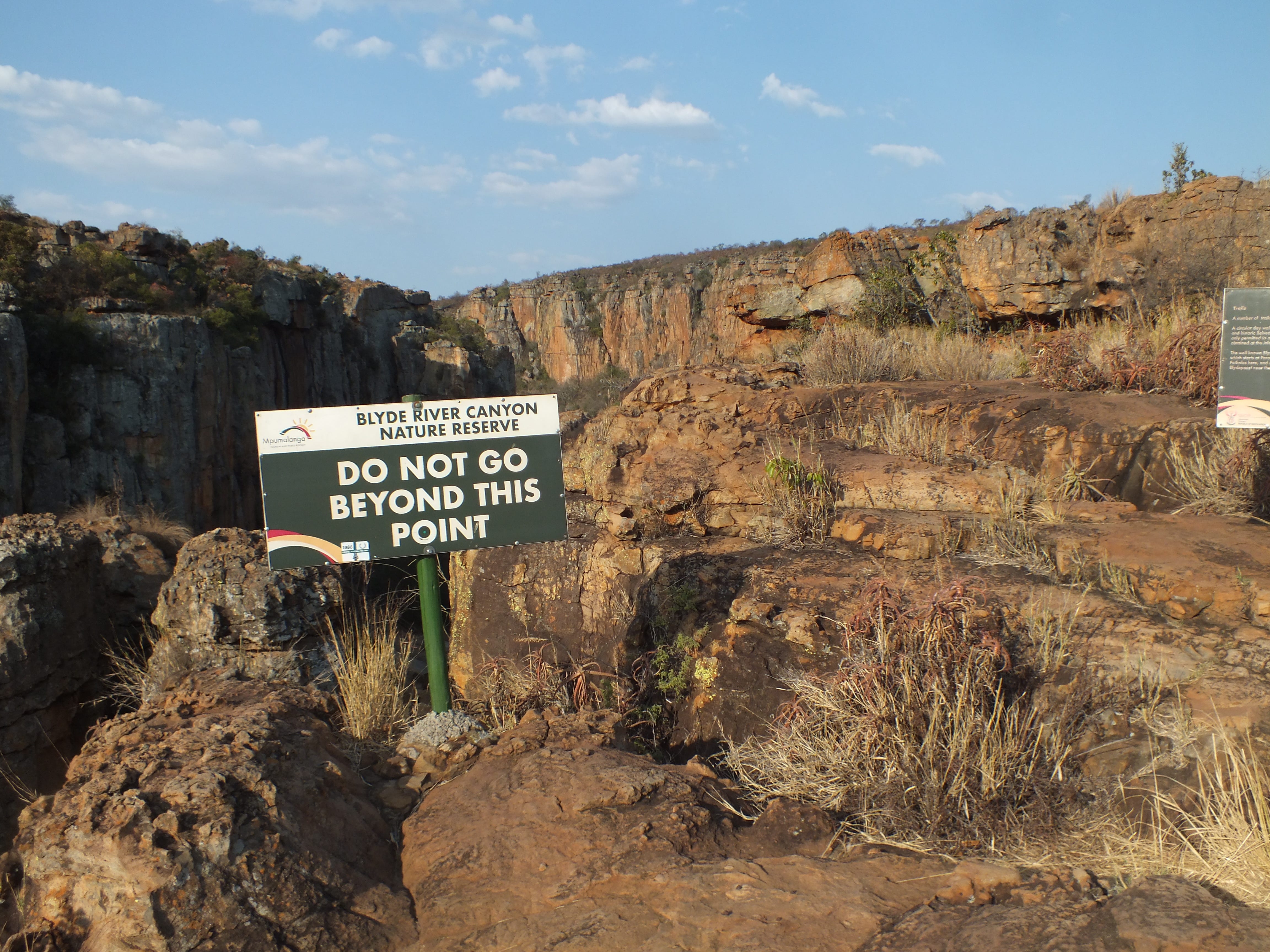
Blyde River Canyon, one of the largest of its kind on earth, is framed on one side by the distinctive rock formations termed the Three Rondavels. A seven kilometer hike brought us by spectacular (albeit somewhat hazy) vistas, small chasms, cascades, pools and even a mist-belt forest — which provided the perfect setting for a lunch break on that hot day.
Bourke’s Luck Potholes. On one end of Blyde Canyon — lying at the bottom of a deep, narrow gorge — these potholes are the result of some turbulent episodes of serious fluvial eddying during wetter times. The different hews on the vertical rock faces highlight the varied mineralogy of the layers.


Overlooks bearing names such as Wonderview, God’s Window and Pinnacle Rock provide perches from which to peer 800 meters down through a thick haze to the floor of the former rift-valley (now the Indian Ocean coastal plain). Sadly the mist — none too uncommon on the plain if judging from the names of local villages such as “Hazyview,” and compounded by area brush fires — precluded any chance of glimpsing the high-rises of Maputo, the seaport capital of Mozambique.
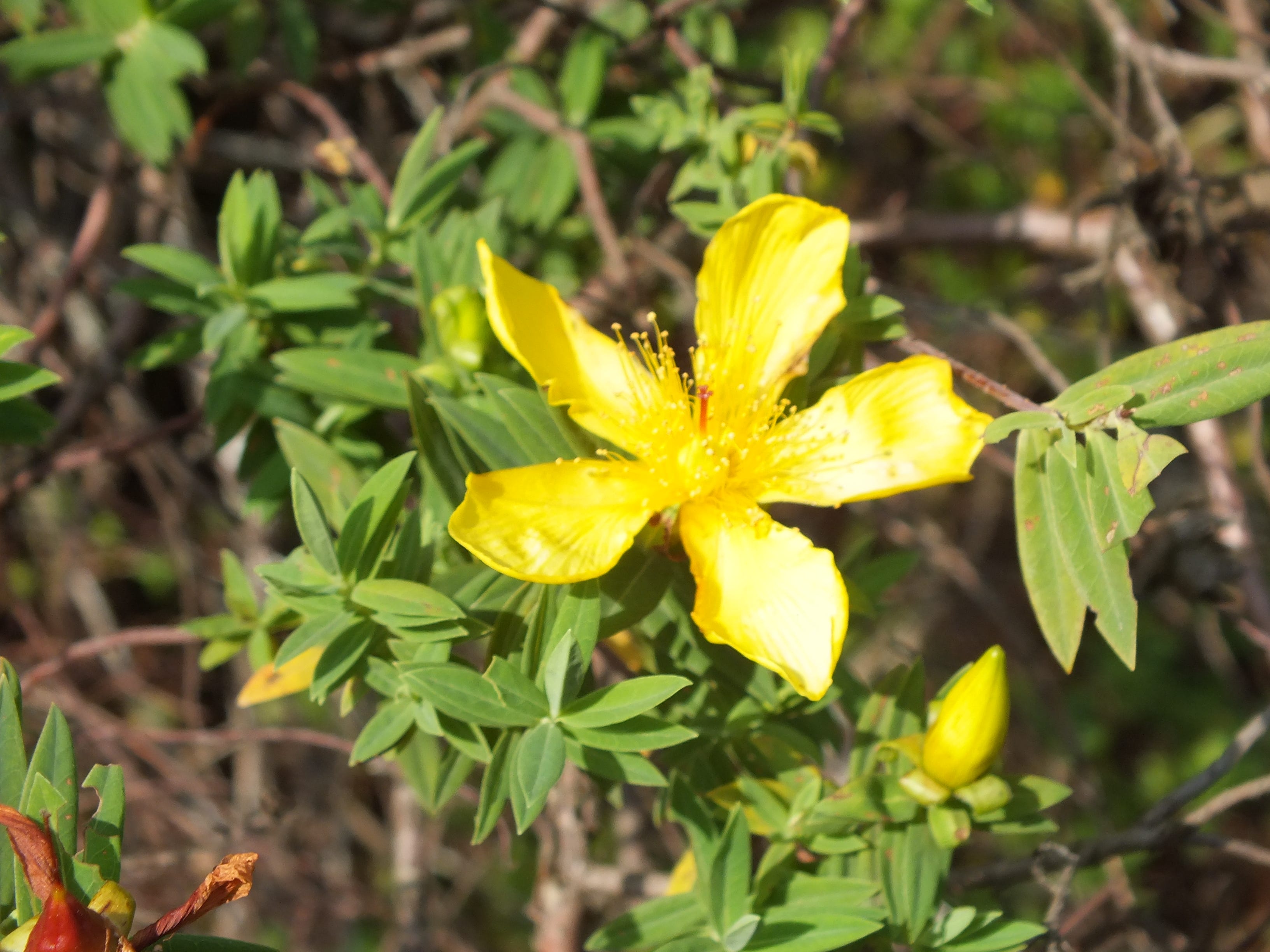
Mist-belt forests — At God’s Window, via a short walk along a boardwalk, one enters a world apart: an enchanting mist-belt forest. This anomalous assemblage of moisture-loving ferns, liverworts, lichens, epiphytes and broad-leaved trees seems as if it had been misdirected on arrival. Indeed the presence of these aberrant forest patches here — in thin bands along the walls of canyons and edges of cliffs — owes to the prodigious amount of rain received in these locations due to orographic effects: basically warm, moist air coming from the Indian Ocean is forced up by the escarpment walls, condensing and precipitating as it reaches the cooler, higher altitudes. In the many canyons and chasms that incise the escarpment, this moisture and humidity is conserved by the shading and shelter of the rock walls.
Graskop Gorge, featuring a giant swing, zip-line, and forest-lift, is just the place for those seeking an adrenaline rush. The swanky, busy visitor center — where access to everything (via turn-styles) is charged a-la-carte — seems a universe removed from the tranquil, sylvan refuge at the base of the chasm fifty meters below; that is until one of the thrill-seekers belts out a visceral wail on their swinging plunge into the gorge.


Back to some deja-vu moments: driving between these various sites, the forester in me couldn’t help but to be a little in awe (to the apparent amusement of my travel companions) of the vast plantations of pine and eucalyptus that seemed to be everywhere. Indeed, seeing row after row-patch after patch of evenly spaced trees and groves took me back to North America, where — especially in the southeast and northwest — such industrial-scale silviculture is commonly practiced. By the looks of things, the York Timbers company must own a substantial chunk of this province, and to process all of that wood they operate several saw mills and lumber yards around the area. Such vast swaths of near mono-cultures blanketing this sublime mountainous landscape makes me wonder about their cost in biodiversity. What did the previous vegetative cover comprise and what has been lost? But the appetite for wood is everywhere and, at least from what I could see here, sound forest stewardship appears to be in use.
On Friday morning — after stops at a used book store, a hair parlor and a pancake house — it was time to pack up (the fit was tighter now, what with all the additional groceries, books and souvenirs) and head back across the plateau. This return route could just as well have been a field course in the nature of South Africa’s rural economy and how geology and climate can be major drivers of land-use and settlement patterns. Upon cresting the resilient quartzite peaks of the Drakensberg (at 2100 m.), the pine woods gave way to a barren steppe of mostly grasses and scrub that harbored just a few scattered herds of cattle. This sparse cover was likely an indication of the sterile nature of these silica-derived “sourveld” soils and perhaps of a small rain shadow effect. Farther down-slope fields of corn and other grains suggested the influence of a moderation in the climate and soils. Approaching the agricultural towns of Groblersdal and Marble Hall, one could have easily mistaken this area for somewhere in central Florida. Indeed, as the land flattened out, blocks of citrus orchards — interspersed with long metal packing sheds — spoke of a robust citrus industry that shared his land with grape vineyards and fields of basketball-sized cabbages among other vegetables. The warm conditions and near year-round growing season in this protected basin (at about 1000 m.) — coupled with some intensive irrigation — enables this bullish agricultural output. It is little wonder that bags of oranges, grapefruits and avocados can be had around here for just a couple of U.S. dollars.


Passing through the bustling enclave of Siyabuswa, we were entering an historic hub of the Ndebele people. But try as I did, craning my neck this way and that, I could not detect much evidence of the vibrantly painted architecture that is a cultural hallmark of this group. That evening, finally back in my hot, dusty village on the lower end of the plateau — a level land of thorn trees and cow herds — I was struck by the amazing variety — in nature, topography, climate and communities — that the landscape had so lavishly rolled out over just a few days. Now, if I could just figure out a way to impart this sense of awe and perhaps agency to my young learners…the rightful inheritors of its bounty.
Fabulous description and comparison. The God's Window area is hard to describe and you nailed it.
Thanks for the geology lesson. Sounds like a fun adventure - did you bungee jump?